Nag Tibba Trek

Nag Tibba (‘Serpent’s Peak’), 3,022 metres (9,915 ft), is the highest peak in the lesser himalayan region of Uttarakhand state (Garhwal Division), and lends its name to the ‘Nag Tibba Range’, itself the next-northerly of the five folds of the Himalaya. It is situated 16 km (9.9 mi) away from Landour cantonment, and around 57 km from Mussoorie in Tehri Garhwal region ofUttarakhand. The ‘Nag Tibba Range’ is amongst three principal ranges of the Lesser Himalayas, which includes the Dhauladhar, and the Pir Panjal, which branched off from the Great Himalayas.

Day 1: Devalsari

Reach devalsari from Mussorie via Thatyur, There are regular Jeeps from old bus stand. Don’t forget to take permission of Devalsari forest rest house if you plan to stay there, otherwise you can also stay in devalsari village.

Devalsari Forest Rest House

Day 2: Nag Tibba Trek

Start early in the day to reach back Devalsari same day. Since the trek goes through the jungle and there is no defined path, I will recommend to hire a guide. You can ask people in Oothad village to accompany you, they shall be charging nominal rates.

If you are planning to stay on the top, then carry tents, food in good quantity since there is no shop on the way. However there is ‘Nag Devta’ temple on the top where devotees will come on festivals.


Har Ki Doon

Har ki Doon means God’s Valley and is one of the famous treks in Uttrakhand. It takes 6-7 days to complete the trek. Trek starts from Sankari and it takes about full day from Dehradun to Sankari, One can reach Purola/Mori and then take late evening share jeep to reach Sankari.GMVN at Sankari can be booked in advance to avoid any accommodation problem later on. There is a check post at Naitwar where national park charges are charged, it is about 2 km before Sankari.

Your trek plan will depend on how you want to cover your distance till Taluka, some people prefer to walk to this place and this will take 6 days while others by taking Jeep will take 4 days till Taluka.

Har ki Doon


Day 1 Trek to Seema from Taluka

It is 14 km trek on bank of ‘Tons’ river and is easy in the start. There is village Ganger after 10 km and small tea shop over here- serves Tea, Maggi and Namkeen. Trek crosses the river on both sides several times and there is picturesque water ‘Atta Chakki’ on the way.

There is forest rest house and GMVN at Seema which can be booked before or you can book it on the spot depending upon the availability of the place. (Picture of Atta Chakki on the way)

Day 2 Trek to Har ki Doon

It is about 10 km trek from Seema to Har ki Doon and takes about 4-5 hours depending upon your speed; you may see snow in the last 2 Kms of the trek.

There is Forest rest house and GMVN at the top, which you will have to book before the trek or you have to tell Guard (Chowkidar) in OSLA to accompany since they open the place only when some tourists are there. Chowkidar makes food also in Har ki Doon however it is advisable to carry some food along.

Some people go further on the trek, if you are planning to go further to HKD then choose months of May-end, June since there is heavy snow in April.

 Day 3 Trek back to Seema/Osla

You can return today from HKD to Osla/Seema or go to Ruinsara Tal depending upon the number of days and cloths/food you have. Guide is recommended for Ruinsara Tal trek.

Day 4 Trek back to Sankari
Today you will have to start early from Seema to reach early Taluka so you can carry early morning vehicle to Sankari.


Dudh Sagar Trek

Carrying Deepak’s Camera,I Reached Yeshwanthpur station with the help of Alok. I, Nagraj and Shiva boarded Vasko Link express. Prabhu and Swamy boarded train from ‘DavanGere’.Prabhu being into adventure tour planning form long time and knows all the basic things to bring which made his rucksack quite heavy.

Dudh Sagar

18 Sep 2010
we reached Castle Rock station 11 AM. We started walking in the rain and changed cloths in abandoned house on the way. It was trek of (15 KM) railway track and we had our breakfast of ‘awaleki’ or ‘poha’ around 12:30 (thanks to Prabhu for cooking). There were leeches on the way; they managed their breakfast by drinking some blood out of me and Nagraj. We met few groups on the way and reached Castle Rock station around 4:00 clock.

At 4:30 we reached falls, it was biggest fall I have seen till now. After seeing it you will start appreciating the power of nature. There is small shelter near fall where one can put his tent. We were carrying ‘Doom’ tent. We set up tent and collected some water from nearby falls (not ‘Doddhsagar Falls’). In mean time, one more group came there.

Prabhu prepared ‘Sambar-Rice’. We all did dinner and I tasted ‘Theple’ which was brought by other group. During this whole time, one guy use to stand with stick to make place protected from Monkeys. We all slept around 9 o’clock.

19 Sep 2010

Day started with 20-25 monkeys sitting all around out tents and they have searched everything we left outside tents. I and Shiva went out to Falls where we spent some 30 mins and took some photos.

Prabhu prepared ‘Upma’ for all of us which were again very tasty as we were very hungry. Prabhu gave monkeys some ‘Upma’ for compensation as we took their place.

Now there was little change in the plan we decided to leave today itself instead on 20th. We packed out stuff and lunch. Took final glace at fall and started trekking toward ‘Sonalium’. It was 3 Km trek where we waited for ‘Goods-Train’ and reached Kulem (GOA).

From Kulem it was 1:30 hour journey to LONDA. We reached Londa around 6:00 o’clock and went to Ram-Nagar to catch next bus to Hubli which came around 7:30 PM. We reached Hubli around 10 o’clock took snacks over there and left for Bangalore.


Roop Kund

Why is it famous ??

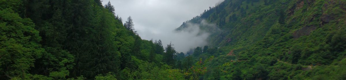
Roop Kund is famous because of 500+ human skeletons found in the lake around 1942 by a forest ranger. View of Trishul (7120m), mystery of skeletons and 4 days of hard trek has made it one of the famous trek for experience and intermediate trekkers.Roop kund lies on way to Nanda Devi Raj Ghat festival, which is celebrated once in 12 years and it is believed all those people may have died on their way to the festival due to hailstorm.

Further trek from Roop kund is towards Homkund which becomes little more difficult as height increases and climbing gear like sleeping bag, tents and warm clothes becomes more important.

Roop Kund Map


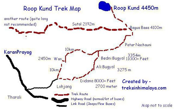
Starting point – Starting point for the trek is Lohjung, It is small town situated in Shivalik range of The Himalaya. To reach Lohjung. –

Delhi to Rishikesh via Bus (Reach Rishikesh early morning)

Rishikesh to KaranPrayag via Bus (Joshimath/Badrinath buses go through KaranPrayag)

KaranPrayag to Tharali (Bus/Jeep whatever available)

Tharali to Lohjung (most of the time you will get Jeep)

From lohjung there are two ways to reach Bedni Bugyal (Bugyal means grass land in the mountains) one is via WAN and another one is via DEDINA

Trek details – day by day itinerary

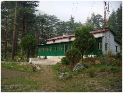
Day 1 – Start early morning to reach WAN this will be around 13 Km of trek, being initial part of trek , this is easy to cover and don’t forget to capture beautiful view of The Himalaya.There is GMVN guest house at WAN and can be booked, more information available on http://www.gmvnl.com/newgmvn/touristbunglows/index.aspx

Day2 – Today You have to reach Bedni Bugyal. Height will slowly reach 11000+ feet and trek will start becoming tougher on the way. You will pass through Gharoli Patal on the way and distance covered will be around 12Km.Bedini has small Kund here, Tourist can visit the place today itself, as next day trek is little tougher that today.

Day 3 – From Bedni to Bagua Basa our next stop, distance is about 9Km, but will take some time as height at Bagua Basa will become 14000+ feet and also path is little steeper. Here one should go for acclimatization walk in the evening to get accustomed to the height..

Day 4 – Today is Roop Kund day.

Roop Kund having height of around 16500 Feet, It is recomened to staty in Bagua basa only. People should start early in the morning and can spend some time at Kund.Total distance covered will be around 10Kms and you should be back to Bagua basa by evening.

Day 5 – Trek back to Ali Bugyal . While coming back, trek becomes easier and height will slowly start decreasing which helps to gain some speed (at the same one need to be cautious as sharp turns and sudden downfalls can lead to injuries)

Today’s trek is till Ali Bugyal.

Day 6 – Trek to Lohjung

Now follow the other way to comeback Lohjung, It will pass through small village Dedina. Total distance covered today will be around 21 Km, It is recommended to start trek earl in the morning to avoid getting stuck in the dark.

Goecha La

Goecha La is beautiful lake situated in the eastern part of Himalaya, and is at height of 5000m.

It is a long trek and need 9 days to complete trek till Goecha la. Trek starts from Yuksom in west part of Sikkim and passes through kanchendzonga national park. It takes almost one day to reach Yuksom from ‘Bagdogra’ the nearest airport, if you reaches there in the late afternoon then you may have to take night stay in Jorthang and catch the next early morning bus/car to Yuksom.

Arrangements in Yuksom –

Hire a guide/porter and buy vegetables, atta, stove, oil etc. since there are very limited options of food on trek route.

You will have to take a the medical form from the Govt. Hospital in Yuksom and permission from Police station (register entry only).Final permission is given while entering the national park, there is check post after Yuksom village.

Goecha La Map

Day 1 – Trek to Tshoka

It is a 14 km trek till Tshoka from Yuksom and there is midway hut at Sachen where trekkers take rest and eat/cook their lunch. Before 2 km from Tshoka, you will pass by Bakhim where forest rest house is there, however partially destroyed by earthquake.

It is advised to carry ‘A’ shape tent since Dome tent does not help much, however at time of need you can sleep in dining room along with porters who come with tourist groups.

Day2 – Trek to Dzongri

It is another hard day, Trek start getting steeper and higher and take about 3/4 hours (depending upon your speed) to reach Phedang. There is water source available in Phedang some 2km off route; you will have to request your guide/porter to get some water.

Phedang to Dzongri is one more difficult path, first 1:30 hour is steep hike to reach deowali; Dzongri is visible from here and takes 30mins to reach.

Day 3 – Rest Day

After climbing for 2 continuous days, it is advisable to acclimatize and give yourself a rest for the day. In the morning (around 5:30AM) you can trek to nearest mountain and kanchendzonga is very clear from there.

Day 4 – Trek to Thangsing

It is 7-8 km trek. There is kitchen in Thangsing and one can stay relatively easy here as compare to Lamune. Leave early morning for Goecha la next day however it is difficult to make till third view point from here.

Day 5- To Goecha la and back to Dzongri

Advised to start early in the day since lot of distance is needed to be covered, reach Goecha la and back to Dzongri. One can also stay back in Thangsing however due to temperature condition it is better to be back in Dzongri.

Day 6 & 7 – Trek to Tshoka/Bakhim

Next two days are going to be steep down trial, first night can be spent at Bakhim and making the next journey easier till Yuksom.